Ferries from Sami (Kefalonia)
Offers, Timetables and Prices


How do I get departing from Kefalonia? Find the best ferry from Kefalonia with ferry booking system by NetFerry. Our site allows you to compare the routes departing from Kefaloniadeparting from Kefalonia along with crossing times, journey times and prices.
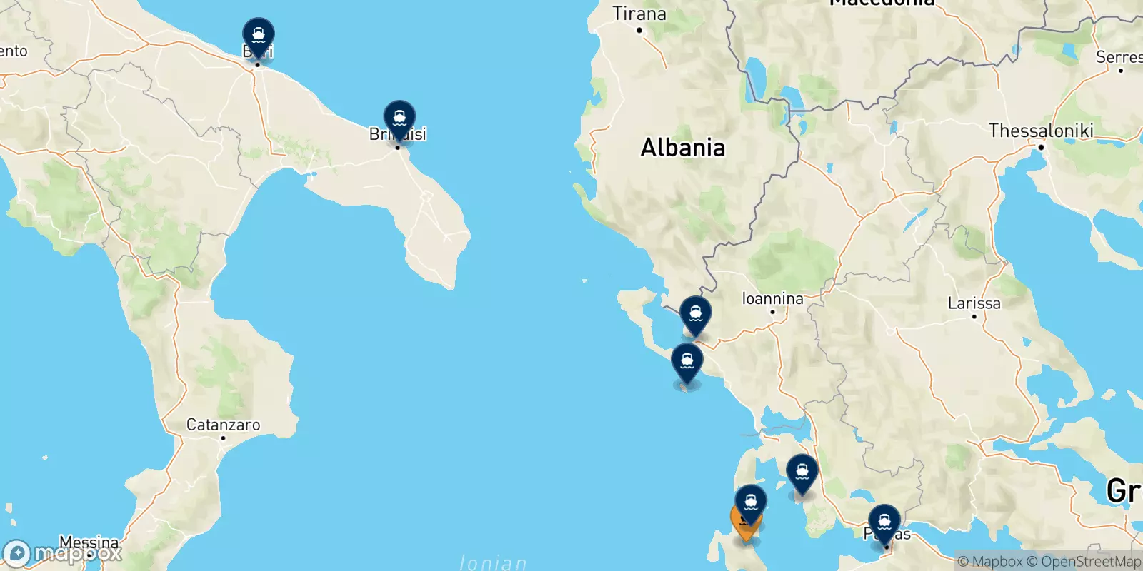
Kefalonia has routes with Ionian Islands (Pisaetos/ithaka), Greece (Patras, Kyllini and Astakos) and Italy (Bari). The between Kefalonia and any other destination lines are covered by well known ferry operators such asVentouris Ferries, Ionion Pelagos and Levante Ferries Group who offer a total of 40 weekly connections with traveling times ranging between 20 minutes and 18 hours 15 minutes (primarily morning and afternoon departures). You can also get to your destination with your car because ferries that operate on this crossing allow vehicles.
Still waiting to book? Book your trip now and travel with ease, thanks to NetFerry services!

The port of Sami is on the island of Kefalonia, located on the north-eastern coast. There are connections with national and international ports from Sami.
The port is small and there are some beautiful beaches in the immediate vicinity. There are many tourist services at the port including a taxi service and buses to other locations on the island including Argostoli, Poros, Agia Efimia.
The nearest airport is on the island itself, eight kilometers from Argostoli, and 33 kilometers from the port of Sami.
Address: Poseidonos, Kefalonia 280 80, Greece
Directions: Google Map @ Sami (Kefalonia), port
Do you want to find out more about your journey from SAMI (KEFALONIA)?
SAMI (KEFALONIA) is connected to ASTAKOS, KYLLINI, PATRAS and PISAETOS (ITHAKA) (GREECE)BARI (ITALY).
The routes from SAMI (KEFALONIA) are served by Ionion Pelagos, Levante Ferries Group and Ventouris Ferries.
SAMI (KEFALONIA) port is located on Poseidonos, Kefalonia 280 80, Greece. Directions to the port can be found here Google Map @ Sami (Kefalonia), port.
If you are looking for more information on your return journey, visit our website Ferries to Sami (Kefalonia) .